 NeoBit Daily
Introduction to Wearable GPS Accuracy for Hikers
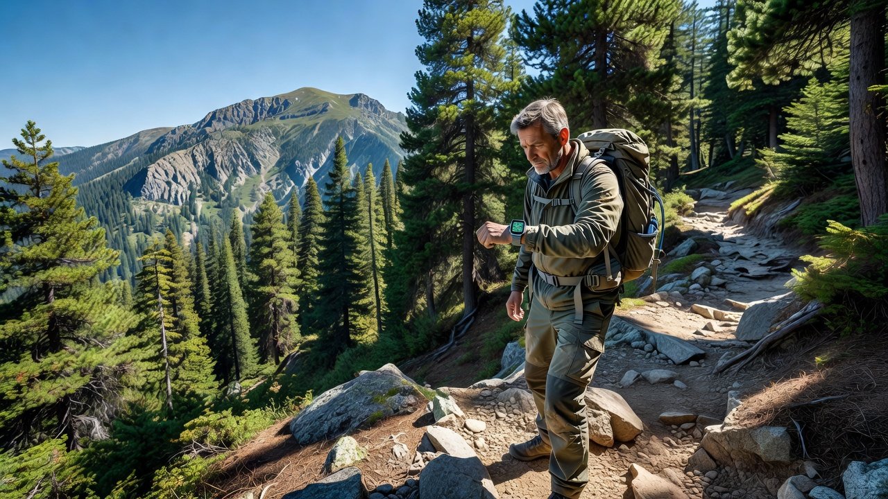
In 2026, hikers rely heavily on wearable devices for precise navigation in remote areas where cell service is unreliable. This comprehensive guide focuses on real-world GPS testing methods tailored specifically to outdoor adventures, helping you evaluate performance beyond basic fitness tracking. Whether you're diving into the latest gadget reviews or scanning wearable reviews for the best options, understanding accuracy metrics can mean the difference between a safe, enjoyable trek and potentially dangerous disorientation. GPS technology in wearables has advanced with multi-band receivers and improved algorithms, yet real-world conditions still introduce variability that lab tests often overlook.
Key factors like satellite connectivity, device-specific algorithms, and environmental interference play major roles in determining how reliable your wearable will be on the trail. We'll explore in-depth comparisons between leading models from Garmin and Apple Watch, common pitfalls that affect thousands of hikers annually, and practical integration with smartphone apps for enhanced route logging and post-hike analysis. By the end of this guide, you'll have actionable insights to make informed decisions for your next remote adventure.
Top Devices: Garmin and Apple Watch Models for Hiking
Garmin devices such as the Fenix and Forerunner series consistently rank high in gadget reviews for their robust multi-band GPS support and long battery endurance on extended trails. These models excel in providing detailed elevation profiles and offline topographic maps that prove invaluable when venturing off-grid. On the other hand, Apple Watch Ultra models offer seamless integration with iOS ecosystems and solid performance in mixed environments, though they may vary more noticeably in challenging terrains with heavy foliage or steep inclines. In recent wearable reviews, these two brands stand out for features like real-time tracking, customizable alerts, and the ability to handle multi-day expeditions without frequent recharging.
When choosing between them, consider how each handles elevation data accuracy and route logging during extended hikes. Garmin often provides more granular data points per minute, while Apple Watch emphasizes user-friendly interfaces for quick glances at progress. Testing both side-by-side reveals nuances that marketing materials rarely highlight, such as how software updates in 2026 have refined signal processing for better performance in transitional zones between open fields and forests.
Common Error Factors in GPS Performance
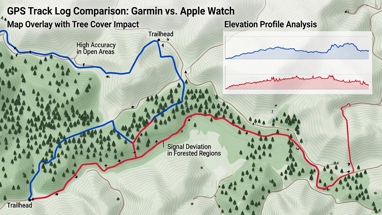
Tree cover remains one of the most frequent causes of signal blockage, leading to positional drifts of several meters or more as the device struggles to maintain lock on multiple satellites. Elevation changes frequently introduce inaccuracies in barometric altimeters that work alongside GPS, especially during rapid ascents or descents where pressure readings fluctuate unpredictably. Other notable issues include urban canyons near trailheads that create multipath interference and adverse weather conditions like heavy rain or dense fog that weaken satellite signals overall.
Understanding these factors through systematic testing in varied environments reveals limitations early, allowing hikers to anticipate and mitigate risks. For instance, a device might perform flawlessly on a sunny ridge but require manual recalibration once entering a valley with partial canopy. Incorporating knowledge from sources like official trail mapping resources helps contextualize these errors against known benchmarks.
5-Step Testing Protocol for Trail Accuracy
Developing a repeatable testing protocol ensures your evaluations yield reliable, comparable data across different devices and conditions. Follow these steps in sequence for optimal results:
- Prepare your device thoroughly by updating to the latest firmware, calibrating all sensors in a wide-open area with clear sky view, and setting consistent recording intervals such as one point every second for high-resolution tracking.
- Select a known trail route featuring pre-mapped waypoints sourced from authoritative databases, ensuring the path includes a mix of open terrain, moderate tree cover, and elevation shifts to simulate realistic hiking scenarios.
- Record GPS data continuously while maintaining a steady hiking pace, noting environmental variables like time of day, weather, and any visible obstructions at regular intervals to correlate with later analysis.
- Compare logged tracks against reference maps or simultaneous readings from multiple devices, using software tools to overlay paths and quantify deviations in distance and elevation metrics.
- Analyze all deviations systematically, categorizing errors by cause such as canopy density or slope angle, and document patterns that emerge across repeated tests for deeper insights into device reliability.
This structured protocol ensures repeatable, data-driven results suitable for any wearable under review, transforming subjective impressions into quantifiable evidence that supports better purchasing decisions.
Example Hike Scenarios with Results
Consider a detailed 10-mile forested trail test conducted under partly cloudy conditions: Garmin models demonstrated average deviations under 5 meters across most segments, with only minor spikes near dense clusters of evergreens. In contrast, the Apple Watch performed admirably on open ridges but exhibited greater drift exceeding 10 meters when under heavy canopy, highlighting the need for supplemental navigation aids in such zones. Another scenario involved a multi-hour mountainous loop with significant elevation gain, where both devices maintained solid accuracy on exposed sections yet required periodic pauses for signal reacquisition in shadowed gullies.
These real-world examples underscore how specific trail characteristics influence outcomes, providing hikers with benchmarks to interpret their own test data effectively. Repeating similar scenarios seasonally can further reveal how software optimizations or hardware tweaks in 2026 models address previous shortcomings.
Battery Impact Analysis During Extended Use
GPS tracking in high-accuracy modes drains batteries at accelerated rates, often reducing runtime by 30 to 50 percent compared to standard activity tracking. Hikers should conduct dedicated power consumption tests over multi-hour outings to determine the optimal balance between precision and endurance, particularly on remote adventures where recharging options are nonexistent. Factors like screen brightness, connected app syncing, and additional sensors such as heart rate monitors compound this drain, making it essential to experiment with power-saving profiles during protocol runs.
Analysis from extended field tests shows that enabling multi-band GPS selectively rather than continuously can extend usability without sacrificing too much positional fidelity. This knowledge empowers users to plan routes that account for potential low-battery contingencies while still capturing essential navigation data.
Integrating with Smartphone Apps for Route Logging
Pairing wearables with dedicated smartphone apps enables seamless data export and advanced visualization of your hiking routes. Leading options from Garmin and Apple facilitate this process, allowing detailed post-hike breakdowns including speed variations, elevation graphs, and shareable maps. For cross-referencing with official geographic information, integrate outputs with resources available through the U.S. Geological Survey or the National Park Service websites, which provide high-quality baseline data for validating wearable logs.
Such integration not only enhances accuracy verification but also supports community sharing of trail conditions and device performance insights among fellow outdoor enthusiasts.
FAQ on Choosing Devices for Remote Adventures
Q: Which device handles tree cover best in 2026 tests? A: Garmin's advanced multi-GNSS configurations often deliver superior results in dense vegetation according to aggregated wearable reviews and field comparisons.
Q: How critical is battery life consideration for GPS-focused hikes? A: Extremely important—always validate power profiles through your own protocol testing to ensure the device lasts the full duration of planned routes.
Q: Can smartphone apps meaningfully improve overall tracking accuracy? A: Yes, hybrid approaches combining wearable GPS with phone-based corrections frequently reduce cumulative errors in logged routes.
Q: What should beginners prioritize when selecting a first hiking wearable? A: Focus on models with proven multi-band support and intuitive interfaces, then apply the 5-step protocol to confirm suitability for your typical terrain.
Q: Are there seasonal variations in GPS performance to account for? A: Yes, foliage density changes and winter snow cover can alter signal behavior, warranting repeat tests across different months.
Conclusion
Mastering these GPS accuracy tests in 2026 empowers hikers to confidently select and optimize reliable wearables for any remote adventure. Apply the insights from this guide, including the detailed protocol and real-world examples, to enhance safety, enjoyment, and navigational precision on every trail.


No comments yet. Be the first!